Artec Jet is a high-speed mobile LiDAR mapping system that combines SLAM-based positioning and AI-powered autonomy to capture sites, facilities & infrastructure, even in GPS-denied environments – in minutes rather than hours, with survey-grade accuracy.
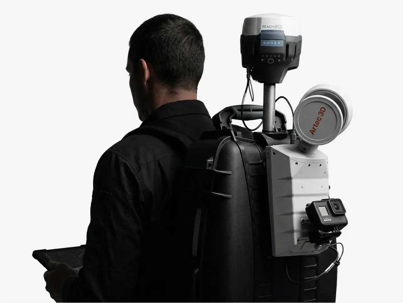
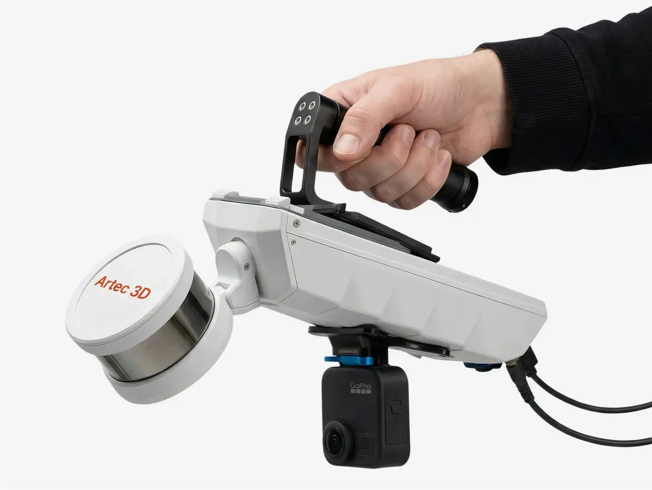
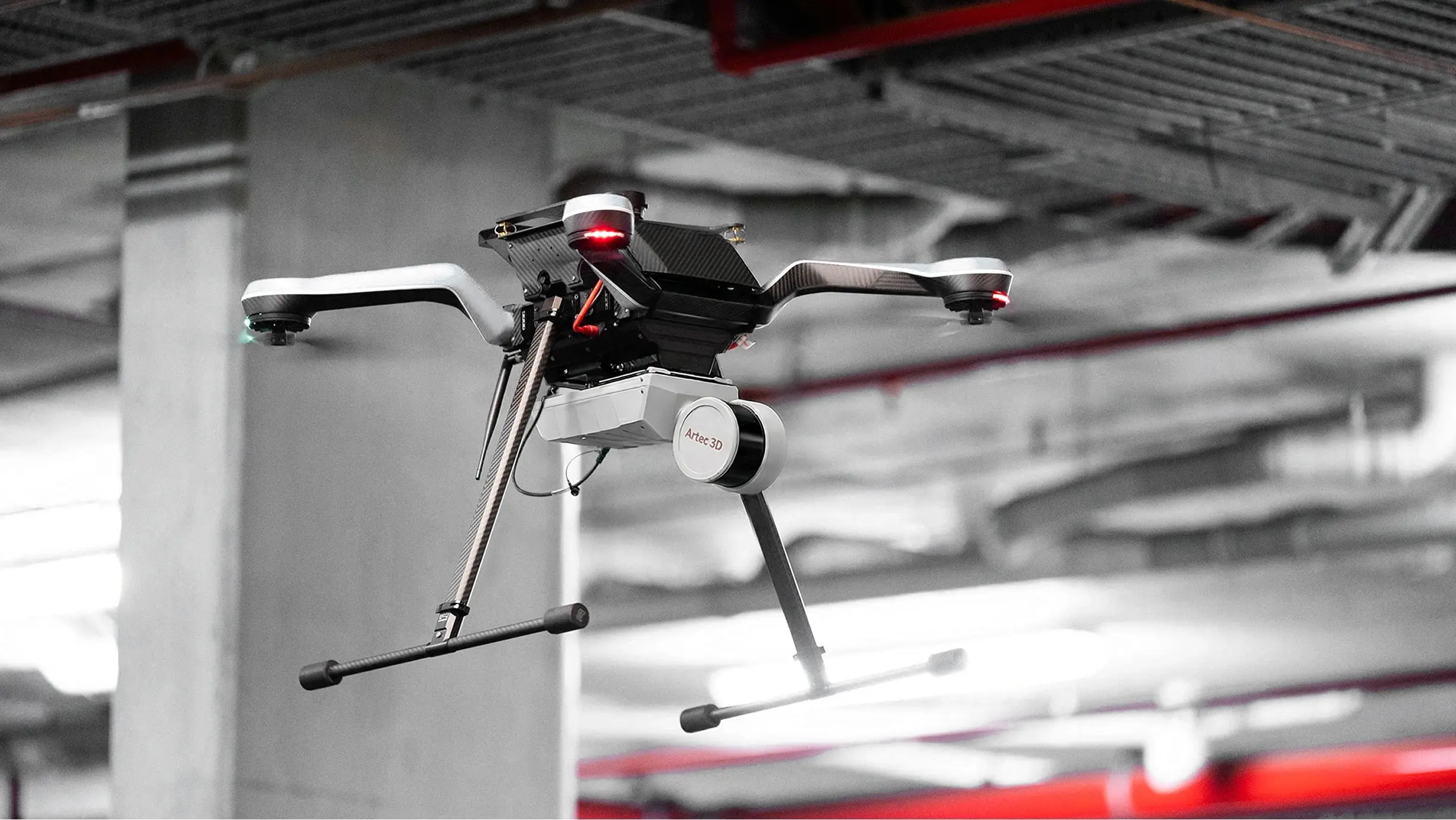
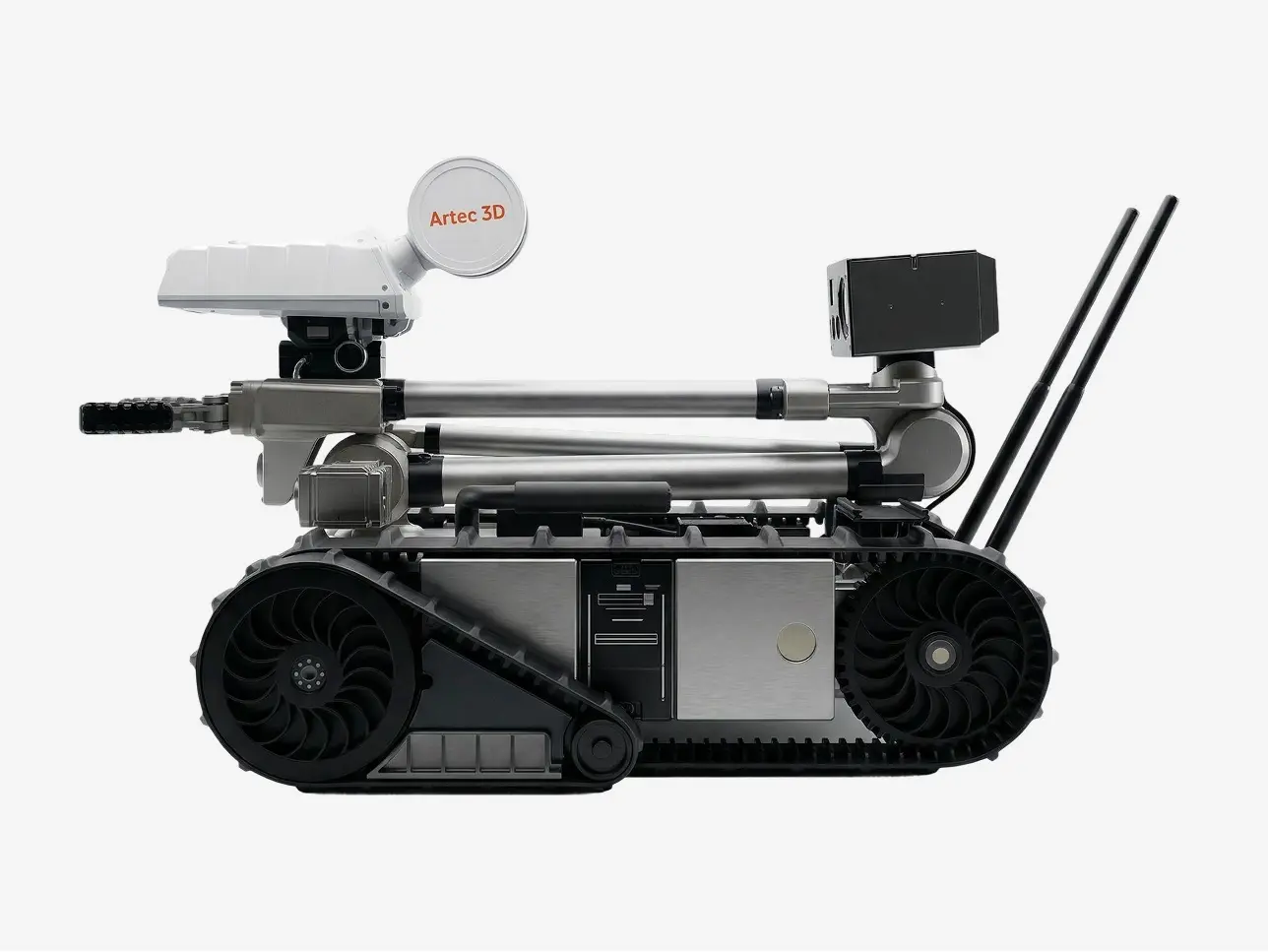
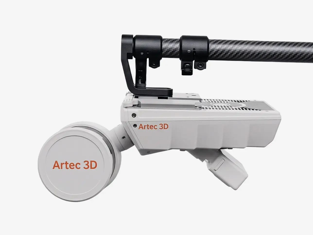
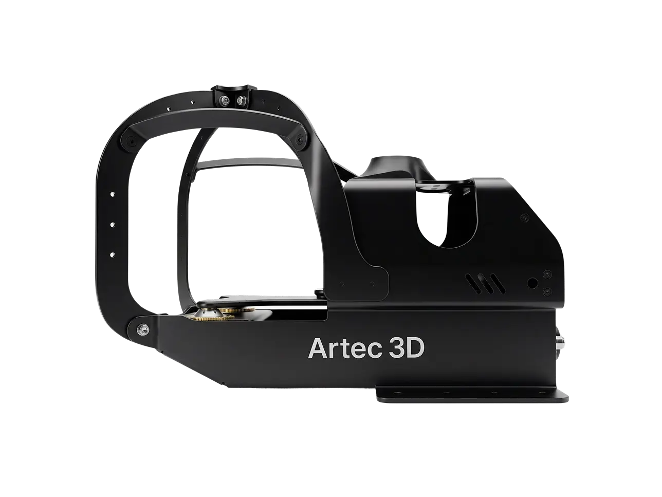
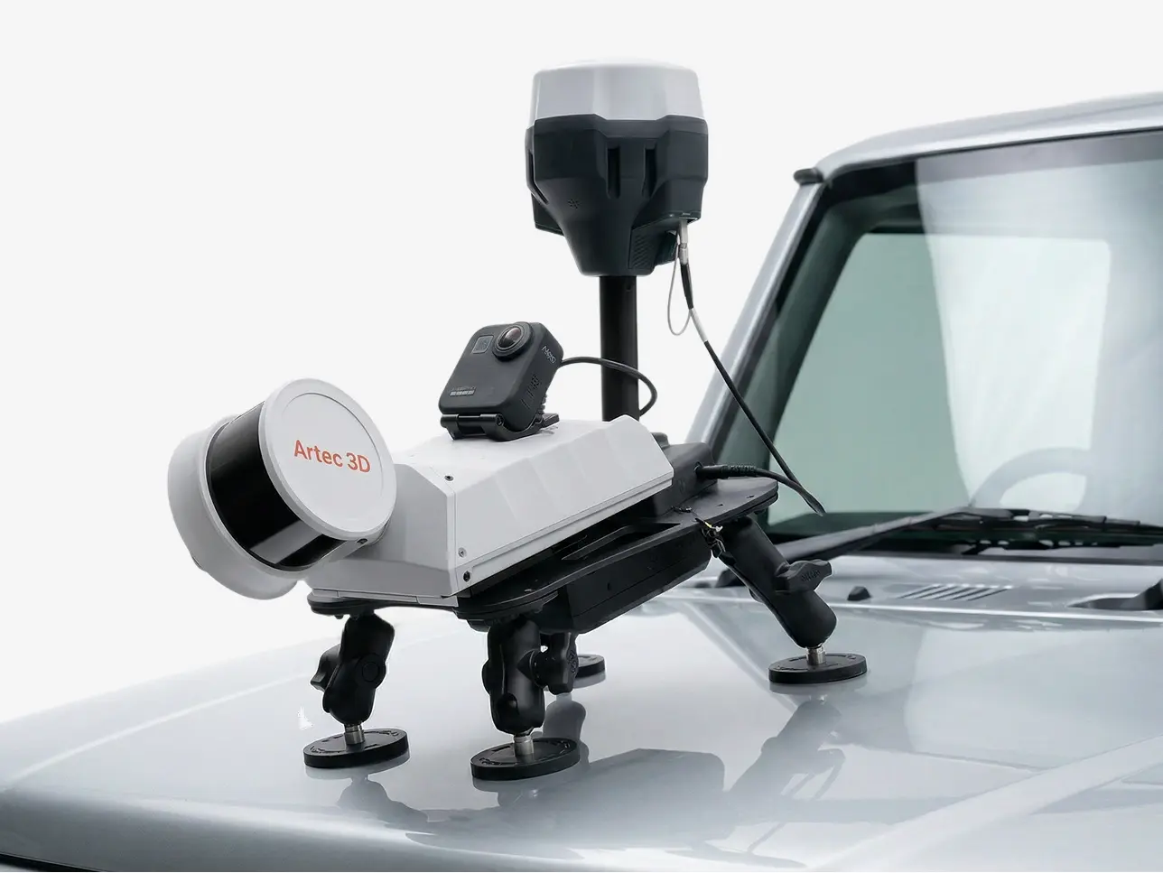
Capture by hand, or mount to a backpack, robot, vehicle, or drone. Artec Jet offers multiple different deployment modes in a single compact, lightweight device. Choose the modality that best suits your application, whether it be open-air surveying or underground mapping, and ensure that on-site teams steer clear of hazardous, hard-to-reach areas.
Within the mining, construction, defense, public safety, and civil infrastructure industries, Artec Jet captures accurate data, ideal for digital twins, as-built documentation, volumetric measurement, clash detection, and inspection.
Together with Artec Ray II and Leo, scanners well-suited to large-object and fine-detail capture, Artec Jet enables a complete pipeline for digitizing everything from sites to components.

Artec Jet’s high-resolution LiDAR sensors and industry-leading SLAM technology deliver detailed point clouds at high speed – for reliable data capture over wider areas in less time.
Gather accurate data anywhere, in any conditions, without having to rely on external infrastructure such as GPS guidance.


Together, Artec Jet’s features, accessories, and advanced software ensure that you get the job done right, first time – boosting productivity and efficiency without scaling risk, cost, or operational friction.
Artec Jet streams point cloud previews to a companion app during scans, giving instant confirmation that all data is captured and no rescanning is required.
With a 360° × 290° field of view, Artec Jet captures dense, shadow-free point clouds with full coverage in a single pass.
Combine LiDAR data with imagery from a supported camera to create vivid, true-to-life 3D representations with immediately recognizable features.
Take advantage of satellite positioning with RTK accessories that improve global accuracy and reduce reliance on control points.
Switch batteries without powering down or losing progress for extended capture at large sites without interruption.
Preview each scan on-site before leaving to ensure complete, usable data is captured on every visit.
Choose the deployment mode that best matches your mission. Easily switch between them in seconds with Artec Jet’s quick-release mechanism – no recalibration, no downtime.
Artec Jet’s AI autonomy engine enables drones to reach the otherwise inaccessible, map GPS-denied environments, and keep your team safe – all without a pilot. Simply set waypoints and the drone will fly autonomously, steering clear of obstacles.

Collision avoidance
Omnidirectional LiDAR creates a safety bubble around the drone, detecting obstacles as small as 2 mm pieces of wire, in the tightest spaces. Your equipment stays protected, your dataflow stays uninterrupted.
Beyond line of sight
Fly autonomously into areas beyond visual range using advanced path planning and proximity sensors to explore unknown environments – capturing data where operators physically cannot go.
Return-to-base failsafe
If battery runs low or conditions deteriorate, Artec Jet automatically navigates back to base along a safe, mapped route. No drone is ever lost, no data is left behind.